
September 30, 2026
NEWSLETTER
When water disappears,the land sinks
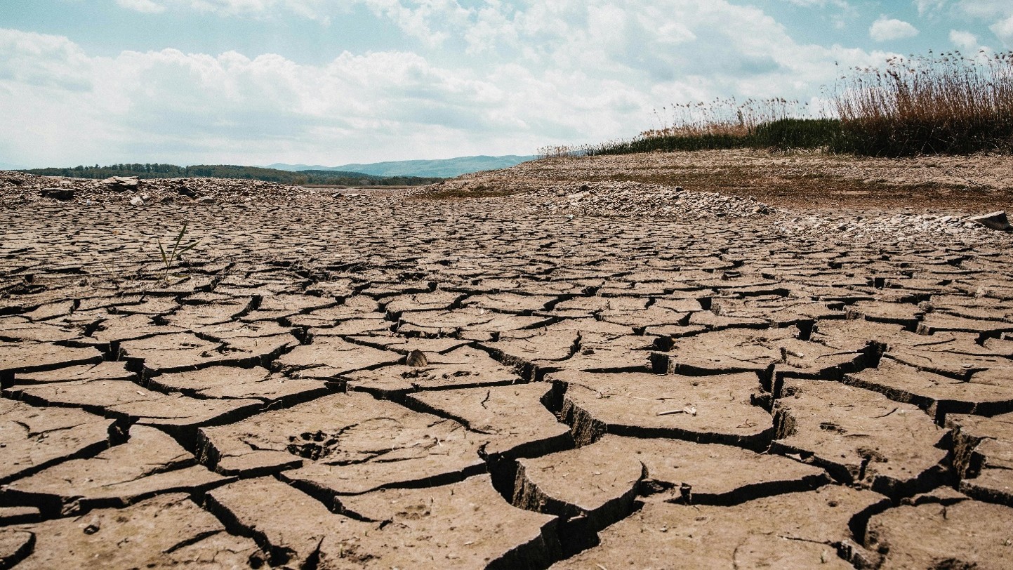
Water scarcity is no longer a problem limited to traditionally arid regions. Recent droughts have pushed major rivers to exceptionally low levels. Even the Danube is experiencing critically low levels, as we speak, affecting navigation, agriculture and energy production.
When surface water becomes scarce, however, demand does not disappear. Increasingly, the alternative is groundwater. Agriculture, rapidly growing cities and industry already depend heavily on underground aquifers. During droughts, pumping intensifies precisely when natural recharge is declining. And when groundwater is extracted faster than aquifers can recover, the consequences are not limited to water availability. The ground itself begins to sink.
FROM WATER DEPLETION TO LAND SUBSIDENCE
Falling groundwater levels reduce pressure within susceptible aquifer systems. Sediments compact, causing the surface above them to subside. This can affect entire cities and agricultural regions, extending across hundreds or thousands of square kilometres.
The scale of the phenomenon is already striking around the world. California’s Sacramento Valley provides an especially vivid example of the connection between drought, agriculture and subsidence.
During the severe 2020–2022 drought, reduced surface-water availability drove intensive groundwater pumping across one of the United States’ major agricultural regions. Scientists subsequently detected dramatic subsidence, with some locations approaching a metre of cumulative sinking.
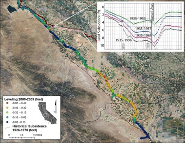
More importantly, part of this deformation represents irreversible aquifer compaction. Once the sediments have compacted, some of the pore space previously available to store groundwater is permanently lost.
This creates a dangerous feedback loop: drought → less surface water → more groundwater pumping → aquifer compaction → land subsidence → reduced groundwater storage → greater vulnerability to the next drought.
Mexico provides one of the world’s most dramatic examples of groundwater-related subsidence.
Large-scale Sentinel-1 InSAR studies have identified major subsidence zones across central Mexico, with rates reaching approximately 45 cm/year in Mexico City. Long-term studies have measured local rates approaching 50 cm/year.
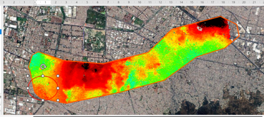
Decades of groundwater extraction have caused extensive compaction of the underlying aquifer system. The consequences are visible throughout the city: buildings, roads, metro infrastructure, drainage networks and water pipelines are exposed to differential deformation.
Ironically, groundwater extraction can therefore damage the very infrastructure needed to supply and manage water.
The Konya Basin, one of Türkiye’s most important agricultural regions, illustrates another side of the problem.
A semi-arid climate, recurrent drought and intensive irrigation have created persistent pressure on groundwater resources. Satellite InSAR studies have detected widespread subsidence associated with declining groundwater levels, while the region has also become known for extensive sinkhole formation.
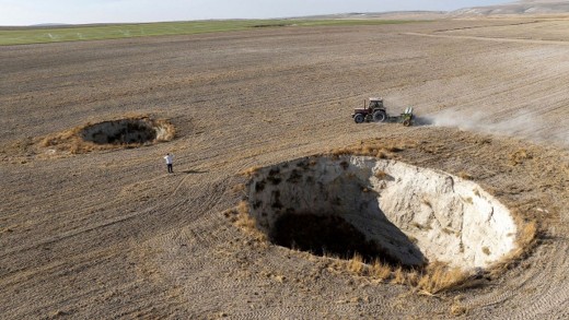
The relationship is particularly concerning: groundwater is extracted to maintain agricultural production, while its depletion contributes to the progressive deformation of the agricultural territory itself.
In Iran, the phenomenon has reached an extraordinary geographical scale. A nationwide satellite study identified approximately 56,000 km² affected by subsidence, primarily associated with groundwater extraction. Around 3,000 km² were subsiding at rates greater than 10 cm/year, with maximum rates exceeding 35 cm/year.
Agriculture is a major driver. Much of the country’s groundwater extraction is used for irrigation, and significant subsidence zones strongly overlap with agricultural areas.
What may begin as a water-management problem therefore evolves into a territorial risk affecting farmland, settlements and infrastructure simultaneously.
The lesson is important: large-scale deformation responds to large-scale water management — but first it needs to be measured.
A PROBLEM LIKELY TO BECOME MORE SEVERE
Several global trends are now converging:
– Climate change and recurrent drought are reducing the reliability of surface-water resources and aquifer recharge.
– Agriculture requires enormous volumes of water and often increases groundwater extraction precisely during periods of drought.
– Urbanisation and population growth are increasing demand from megacities, industry and infrastructure, including in regions already experiencing water stress.
At the same time, groundwater accumulated over decades or centuries can be extracted much faster than it can naturally recover.
The result is that subsidence related to aquifer depletion is increasingly becoming not a local geotechnical problem, but a regional environmental, agricultural and infrastructure risk.
THE MONITORING CHALLENGE IS CHANGING
Traditional instruments — groundwater wells, levelling networks, GNSS stations and local geotechnical sensors — remain essential.
But how do you monitor deformation across 5,000, 20,000 or 50,000 km²? Identify new subsidence zones before damage becomes obvious? And how do you distinguish stable areas from places where deformation is accelerating?
This is where satellite InSAR becomes critical.
InSAR allows ground movement to be measured systematically across entire cities, agricultural basins and aquifer systems with millimetric precision — without installing thousands of sensors across the territory. It makes it possible to identify subsidence hotspots, measure differential deformation, analyse historical trends and continuously detect changes across extremely large areas.
FROM MONITORING TO PREDICTION
GeoKinesia specialises in large-scale InSAR deformation monitoring and advanced remote-sensing analytics.
Our technology transforms satellite observations into actionable deformation intelligence for governments, infrastructure operators, mining and energy companies, civil-protection authorities and other organisations responsible for managing large territories and critical assets.
And monitoring is only the first step.
By combining long-term InSAR time series, deformation dynamics and other Earth Observation and environmental data, GeoKinesia is developing predictive approaches designed to identify changes in deformation behaviour and emerging risk before their consequences become critical.
As drought, urbanisation and groundwater demand intensify, understanding what happens underground increasingly requires observing what is happening above it.
When water disappears, the land moves. And today, we can see it happening from space.
Lorem ipsum dolor sit amet, consectetur adipiscing elit. Ut elit tellus, luctus nec ullamcorper mattis, pulvinar dapibus leo.