Infrastructure Monitoring
INSAR CAN BE HIGHLY INSTRUMENTAL FOR INFRASTRUCTURES' STABILITY MONITORING AND ALERT SYSTEMS
Sustainable development of the society relies heavily on infrastructures, which are physically placed on earth. Furthermore, some of these infrastructures, like earth dams or road/railway embankments, can be considered as geo-structures themselves. Earth surface and infrastructures are affected by sudden natural disasters (earthquakes, floods, etc.) and by slow moving deformations such as landslides, subsidence, sinkholes etc. which may pose a serious threat.
A broad range of the monitoring techniques have been developed to provide up to date and precise information on the conditions of different infrastructures and assure their safety. These techniques include more traditional methods such as the land surveying, sensors such as GPS, inclinometers, piezometers, as well as new technologies such as acoustic sensors, fiber optics, drone-based photogrammetry etc.

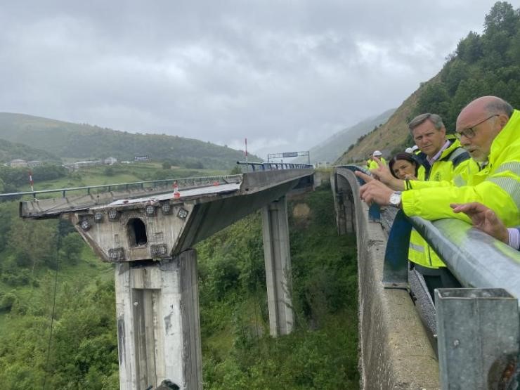
A viaduct collapse in Spain in June, 2022
Enhancing Infrastructure Safety: InSAR for Bridge, Dam, and Tailings Monitoring
These techniques are well suited to monitor for large and modern infrastructures, such as bridges or dams, buildings or wind turbines, but for the technical and economic reasons they cannot be installed on old and smaller infrastructures, so despite the proliferation of different technologies the biggest part of the infrastructures is not regularly monitored or monitored by a means of simple visual observations.
Another obvious shortcoming of these techniques is that the data, which are highly precise and continuous, remain localized, these techniques do not allow to monitor large and remote areas.
The lack of economically effective and sufficiently reliable methods for infrastructures monitoring as well as for the large and surrounding areas monitoring is acute in the developed world, where many infrastructures are aging, and in the developing world where the maintenance budgets are meagre. This leads to accidents such as the Ponte Morandi (Italy) collapse in 2018, or more recent (June 2022) collapse of a viaduct in Spain or of a dam in Kenya in 2018, which killed 50 people, not to mention the notorious Brumandinho dam collapsed, which claimed almost 300 lives.
Remote sensing and InSAR, in particular, is a good answer to that problem, as it allows to obtain information on objects stability as well as on the processes around them.
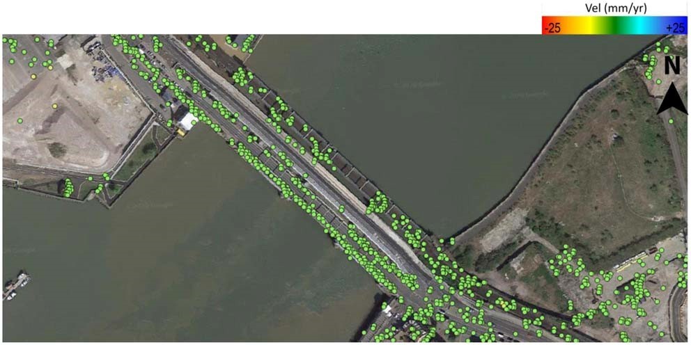
InSAR can be effectively used to monitor for objects stability, allowing to detect early deformations. It is especially instrumental in monitoring the dams, bridges, buildings stability, and offers unique advantages in monitoring the land movements, which can affect the areas around the highways and roads, railways, bridges, reservoirs, powerlines, dump sites and other large and small and remote critical objects and assets. s.
InSAR analysis can also provide critical insight for the pre-design phase development and a site suitability analysis, as this is the only method, which allows to analyze, based on the archived data, historical evolution, and stability of an area.
InSAR is irreplaceable to monitor for stability of the large urban areas, during underground works or if it is prone to subsidence due to the underground water overexploitation or sinkholes formation.

GeoKinesia’s particular focus is the development of InSAR solutions for the infrastructures monitoring. Our proprietary processing chain allows to obtain a high points density, which allows to monitor even “thin” or small infrastructures.
We also develop a unique predictive solution, which allows to detect early and assess the risks related to deformations by a means of a continuous intelligent monitoring of infrastructures and nearby areas integrated with a dynamic numerical modelling.
