InSAR technology offers a number of unique advantages:
Ubiquity: satellite signals cover the whole globe and do not depend on the sunlight and weather. Remote areas as well as highly complex urban areas can be monitored effectively.
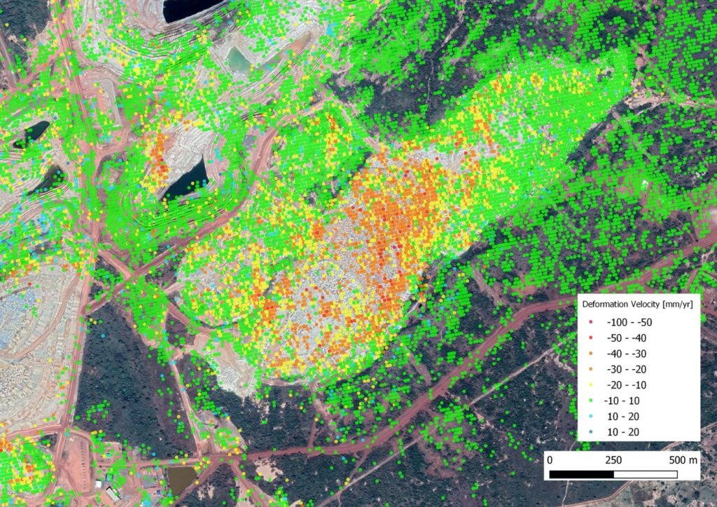
Precision: since the method makes use of the change in phase, its precision is in millimeters or even submillimeter and does not depend on the resolution.
Very high density of points: on a polygon of several square kilometers tens of thousands of points can be obtained, providing experts with opportunity to have a “synoptic view”.
Opportunity to “travel back in time”: as rich archive data are available one can see deformation in the past periods and its evolution in time. This is an essential feature, which also allows to build a solid basis for forecasts and early warnings.
Cost effectiveness: InSAR is by far the most economically effective way to obtain deformation measurement. It represents a fraction of costs involved for in situ measurements or aerial surveillance or any other methods.
It is also a strong complement to in situ sensors and topographic data as it provides useful insight without any in situ presence, giving an additional perspectives and also allowing to focus instrument measurements on the highest risks or most relevant areas.