Active Deformation Area Map
Active Deformation Area Map
Active Deformation Area Map (ADA) is the first, European Ground Motion (EGMS) based value added service, launched by GeoKinesia.
ADA provides an easy and convenient way to access EGMS database and search online for active deformation areas only, instead of working with the whole dataset, as well as obtain deformation data such as deformation velocities and time series. The service provided on web-based GIS platform.

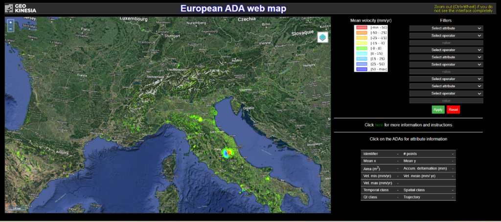
Active Deformation Area online interface

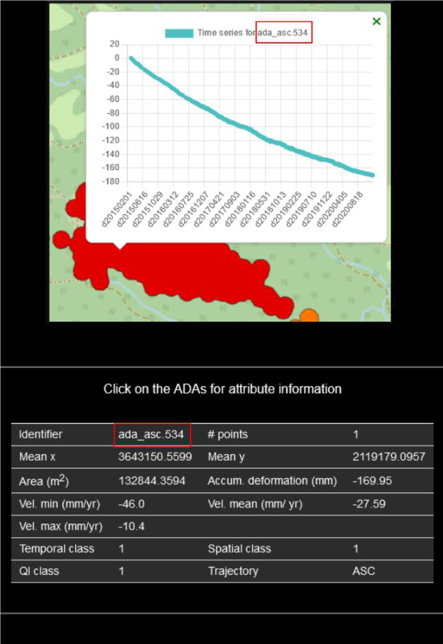
Deformation data and time series for a randomly selected point
EGMS is the 1st continental scale ground motion service in the world, which provides free of charge annual update on natural and anthropogenic ground motion over the Copernicus Participating States on the online platform, which also allows data visualization and analysis. This is the service developed under the aegis of European Environmental Agency (EEA) and is a part of the Copernicus Land Motion Service.
ADA has a simple and user-friendly interface, which allows to browse the map, select areas, points and obtain statistical data by clicking on individual points or polygons.
This is free of charge service for all registered users.
The service covers all the countries contributing to Copernicus and the United Kingdom (UK), except Norway, Sweden, Finland, Iceland, Estonia, Lithuania and Latvia. The exclusion of these seven countries is related to the discontinue nature of the time series provided by the EGMS due to snow-cover, which can compromise the quality of the interferometric Synthetic Aperture Radar (InSAR) results, and thus, the reliability of the ADAs.
The complete list of countries included in the first delivery of the European ADA web map are: Austria, Belgium, Bulgaria, Croatia, Cyprus, Czech Republic, Denmark, France, Germany, Greece, Hungary, Ireland, Italy, Luxembourg, Malta, Netherlands, Poland, Portugal, Romania, Slovakia, Slovenia, Spain, and United Kingdom.
This is the first time that ADA data is made publicly available at a continental level.
