Sinkhole Monitoring
Exploring the Formation and Impact of Sinkholes
Sinkholes, which is defined as the depression or a hole in the earth surface, cause by underground geological processes, is quite a common phenomenon.
Although not as dramatic in its appearance as tsunami, flood or landslide sinkholes may still be dangerous, posing threat to lives and property. Private houses, in particular, often suffer from deformations induced by nearby sinkholes or even destruction. In the worst accidents several multistore buildings have been sucked into the sinkholes, leading to numerous fatalities.
Sinkholes are most common in so called karst terrain, these are the terrain where underlying soluble rocks such as limestone, carbonate rock, salt beds etc, can be dissolved by underground waters or by water from rainfall when it moves down through the soil, creating underground spaces and caverns. It also can be cause by mining activities, especially the salt or potash mining, when solution mining is employed.
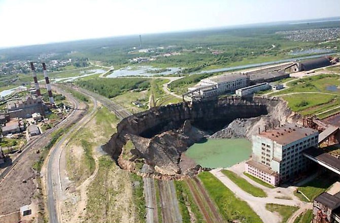
Giant sinkhole in Berezniki, Perm region, Russia
Another reason for sinkholes and a growing concern around the globe is underground water depletion causing underground voids formation and consequent sinkholes development.
Sinkholes may reach gigantic sizes of hundreds of meters. When they emerge in the habitation or industrial areas, their occurrence leads to catastrophic consequences.
Smaller sinkholes may not be as dangerous and pose no threat to buildings or large infrastructure objects but still can be powerful distractors for the quality of the auto roads or a threat to the railways.
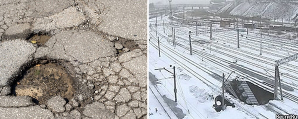
Sinkhole under the railway and asphalt road damaged by a sinkholes
Sinkholes are especially dangerous as their formation and development remain invisible for a long time, often until the moment of collapse. Even when a sinkhole is detected, it is often very difficult to determine its scale and the danger it poses, as it requires a thorough investigation of the underground processes using special equipment such as ground penetrating radar or electrical resistivity tomography.
There are many regions on Earth, which are highly susceptible to sinkholes, Florida, for example, is one of these regions as well as Causses of France, Middle West, Kentucky, USA, Yucatan Peninsula, Mexico and many more.
InSAR, especially in combination with other methods and on purpose developed algorithms and models, is a highly effective tool for sinkholes formation detection and monitoring. It is probably the only practical tool, which allows monitoring the objects stability in the areas which might be affected by a sinkhole. InSAR can also be used for early warning generation as the sinkholes usually demonstrate precursory spatio-temporal deformation patterns, which can be detected and analysed, using InSAR in combination with AI based models or other tools.
GeoKinesia possesses strong experience in providing sinkholes monitoring service to the public customers in Europe and across the world. We worked with road authorities and insurance companies on a number of cases, where a sinkhole was a cause of deformation and inflicted damage on different property.