1 JUNE, 2025
Newsletter
Space archaeology: digging from 500 km above
Satellite-based remote sensing techniques are designed, with few exceptions, to monitor the Earth’s surface. But the surface can tell, it turns out, a lot about what is underneath — and these stories are fascinating.
In this Newsletter, we take a look at an extraordinary application of spaceborne Earth observation techniques: using satellite data to detect buried archaeological treasures. These aren’t necessarily real treasures, but the knowledge they unlock is often far more valuable than gold.
The idea has been around since the early 1980s, when NASA hired its first (but not last) archaeologist, Tom Sever, who believed satellite imagery could be used to uncover traces of ancient human activity.
In the last decade, higher-resolution imagery and the development of other spaceborne techniques have triggered a boom in satellite-data-driven discoveries — in particular, thanks to the renowned work of the “space-based Indiana Jones,” Sarah Parcak, who helped the development what is now widely known as space archaeology.
Her work led to the identification of an astonishing 17 potential pyramids, over 3,000 ancient settlements, and 1,000 previously unknown tombs — in Egypt alone.
In 2015, using satellite imagery analysis, Dr. Parcak’s team identified anomalies on the southwest coast of Newfoundland. The location showed signs consistent with ironworking and turf walls, similar to features found at L’Anse aux Meadows — the only confirmed Norse site in North America to date.
Some other important discoveries made using satellite data include:
- Tanis, Egypt: Detected from space using infrared imagery, revealing previously unknown tombs and streets beneath the surface.
- Amazonian geoglyphs: Satellite images helped uncover massive earthworks hidden under the forest canopy — long before LIDAR surveys confirmed them on the ground.
- Angkor, Cambodia: Remote sensing has mapped out vast urban sprawl and hydraulic systems surrounding the famous temples — systems that were previously invisible under jungle.
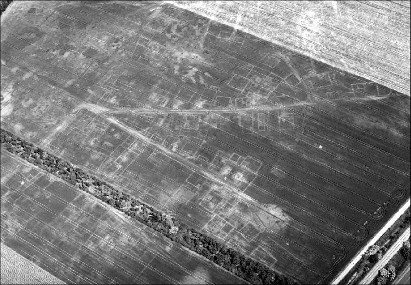
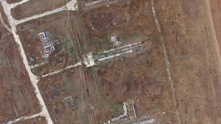
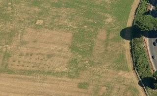
To see what’s hidden underground, one must explore the interaction between buried structures and the surface environment. Features such as walls, roads, or ditches – though invisible – affect the vegetation and soil directly above them. For instance, underground stone may retain less moisture than surrounding soil, leading to reduced plant growth. Conversely, buried ditches may hold more water, supporting lusher vegetation.
These differences manifest as changes in colour, texture, and growth patterns, known as crop marks. From hundreds of kilometres above, satellites equipped with multispectral and infrared sensors can detect these anomalies with surprising clarity — far more effectively than ground-level observation.
Today, archaeologists use this technique routinely to identify locations of potential buried structures. Combined with historical records and field surveys, satellite data is helping to uncover evidence of lost cities, ceremonial complexes, roads, and fortifications — many of which had been hidden for centuries.
However, the task is not simple. The interpretation of remote sensing data remains a significant challenge. Lighting conditions, cloud cover, seasonal vegetation cycles, and soil types all influence how features appear in satellite imagery.
Moreover, satellite-detected anomalies are just hypotheses until verified through fieldwork — sweat and shovel. That’s why archaeologists rely on a multidisciplinary approach, combining remote sensing with historical context, ethnographic research, and on-the-ground validation.
And yet, satellite-based archaeological detection is opening new windows into the human past. In areas that are difficult to access or environmentally sensitive, it offers a powerful, non-invasive way to explore the remnants of past civilizations. As image resolution improves and data becomes more accessible, space archaeology is set to become an even more vital tool — not to replace traditional excavation, but to enhance it, guiding researchers with greater precision and far less guesswork.
For those curious to try their hand at archaeology from orbit — or simply see what modern tools can reveal — there are several excellent platforms and projects that make remote sensing accessible to the public.
GlobalXplorer° – Become a Digital Explorer
Launched by Dr. Sarah Parcak and supported by National Geographic and the TED Prize, GlobalXplorer° is a crowd-sourced archaeology platform. Volunteers can examine high-resolution satellite images to help spot potential looting or unrecorded archaeological features.
ESA’s Sentinel Hub – EO Browser
The Sentinel Hub EO Browser offers access to data from the Sentinel-2 satellite, which captures 10–20 meter resolution images across the visible and infrared spectrum.
You can explore crop marks, vegetation changes, or historical land use patterns directly from your web browser using time-series comparisons and spectral filters.