Permafrost Melting
permafrost Melting
Permafrost Melting represents a serious problem in high latitude polar areas, mostly in Canada, USA (Alaska), Russia, but also in some mountainous, high-altitude areas in other parts of the world, eg Tibet plateau.
The permafrost is subject to short, seasonal but also longer of thaw-freeze cycles – it is natural for permafrost (despite the name) to thaw, the process always induces land deformations of different types and scales.
Latest changes in climate cyclical but also induced by human activities, , however, alter melting patterns causing land deformations in the areas, where they were not observed before and also lead to larger scale deformations.
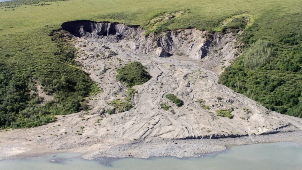
Small scale landslide caused by melting permafrost.
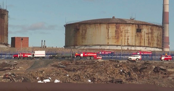
Norilsk Nickel accident, cracked reservoir.
The deformations pose a risk. One noticeable example, in spring 2020 melting permafrost in Norilsk, Russia area caused a deformation of an oil tanker, belonging to Norilsk Nickel – nickel and palladium mining and smelting company, the tanker cracked open, over 20,000 tons of diesel oil was released to the local environment. The damage was estimated at minimum $2Bn.
In Canada, US and Russian some mining operations are located in the permafrost areas and its thaw may pose a threat to the safety of the operations and their infrastructures.
Additional danger represent carbon dioxide and methane, which are contained in the soils and remained frozen for thousands of years. Now, as the soils thaw, the gases are released, sometimes with powerful blasts – compressed methane explode – leaving huge craters and brining havoc to the surroundings. Methane and carbon dioxide, released from the underground, do not help to global warming, adding significant amounts of greenhouse gases.
One of the biggest challenges in melting permafrost related risks management is that the processes often take place in the remote areas, which extend for hundreds of kilometres, where no in situ measurements can practically be taken.
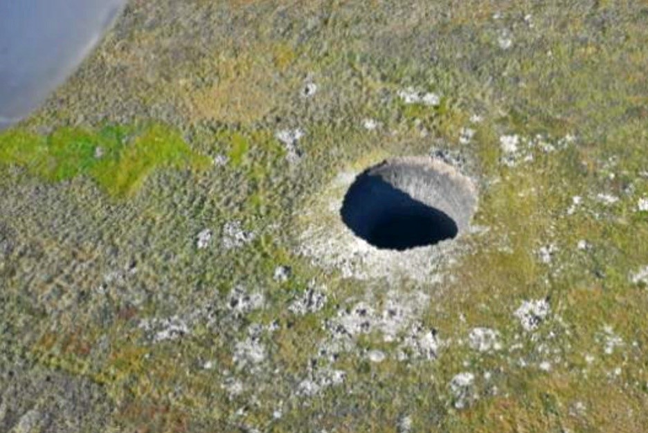
Crater formed by the underground blast. Source: Skoltech
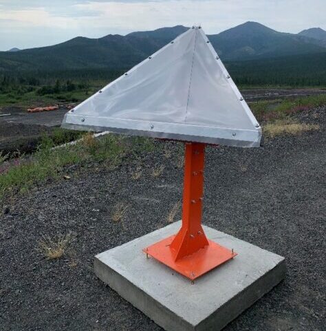
Passive corner reflector used to monitor in winter season
InSAR is the technology, which has been traditionally used to monitor deformations in melting permafrost areas in spite of the difficulty of taking the measurements during the winter season and over areas covered by snow. A number of scientific papers have been published on the subject and the methods of monitoring land deformations in the melting permafrost areas using InSAR often in combination with some other techniques developed.
GeoKinesia has undertaken a number of projects, including some research projects, developing methods to improve InSAR monitoring in the areas, where the permafrost thaw can cause large scale deformations. The company also has experience of developing and actively employing proprietary corner reflectors, passive and active, which help to monitor smaller areas during the snowy periods.