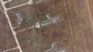
Remote sensing and archeology digging from 500 km above
1 JUNE, 2025 Newsletter Space archaeology: digging from 500 km above Satellite-based remote sensing techniques are designed, with few exceptions, to monitor the Earth’s surface.
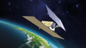
L-band and the next frontier in deformations monitoring
9 MAY, 2025 Newsletter L-BAND AND THE NEXT FRONTIER IN DEFORMATIONS MONITORING The stability of the Earth’s surface is a global concern. Climate change, increasing

Climate change – Is it real?
27 MARCH, 2025 Newsletter CLIMATE CHANGE – IS IT FOR REAL? Under the new American Administration many conventional wisdoms have come under scrutiny and one
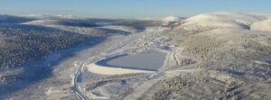
Closed and abandoned mines monitoring
30 JANUARY, 2025 Newsletter CLOSED AND ABANDONED MINES MONITORING Contaminated site of Wolverine Mine, Yukon, Canada Closed and old mines represent a huge and largely
InSAR Technique Improvement – Building Differential Deformation
17 DECEMBER, 2024 Newsletter InSAR: BUILDING DIFFERENTIAL DEFORMATION (BDD) The PSI technique can be used to monitor deformations over very wide areas. An example is
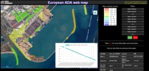
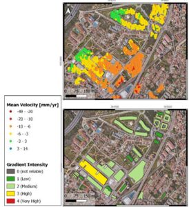
InSAR Technique Improvement – New clustering procedure
15 NOVEMBER, 2024 Newsletter InSAR: NEW CLUSTERING PROCEDURES AND ACTIVE DEFORMATION AREAS (ADA) The PSI technique can be used to monitor deformations over very wide