16 October, 2024
Newsletter
INSAR AND GEOTECHNICAL ANALYSIS
Geotechnical analysis is a regulated practice with developed and strictly controlled guidelines or codes: example can be Eurocode-7 (EU) or Geotechnical Site Characterization Publication No. FHWA NHI-16–072 (US). These codes are applied rigorously.
The codes provide rules and define procedures for site investigation, including field campaigns, derivation of the ground properties, preparation of the ground models, computational methods and the format of the conclusions.
The commonly accepted practices include visual observations, land surveying and soil tests and which involve big manual efforts but leave practitioners with limited information about geotechnical risks and hazards in the area.
The codes are rather rigid and do not necessarily stay apace with the latest technological developments.
This is probably why InSAR – a remote sensing technique, which allows analysing land deformations with high precision over large areas at minimal costs – is not a common practice or a part of a geotechnical investigation.
At the same time InSAR in this context could bring significant benefits to all stages of a geotechnical investigation from the design to the construction to the operation phase.
At the design phase, the historical information on the land movements in the area of interest can equip an investigator with valuable knowledge about the geohazards and the movements in the area and also can be highly useful for a design selection and adjustment. During the construction phase, actual surface geotechnical behaviour can be monitored and implied geological models can be improved and calibrated. During the post construction and operational phase, a subsidence of a new object, which is a typical problem, or its impact on a neighbouring area can be effectively analysed without expensive GPS equipment installation or tedious land surveying campaigns.
Yet, InSAR, which has established itself as de facto a standard in geotechnical monitoring in mining, is
not a widely accepted practice in the geotechnical investigation, as it is not included in the codes and
guidelines and seldomly required by the customers, who usually dictate the scope of studies.
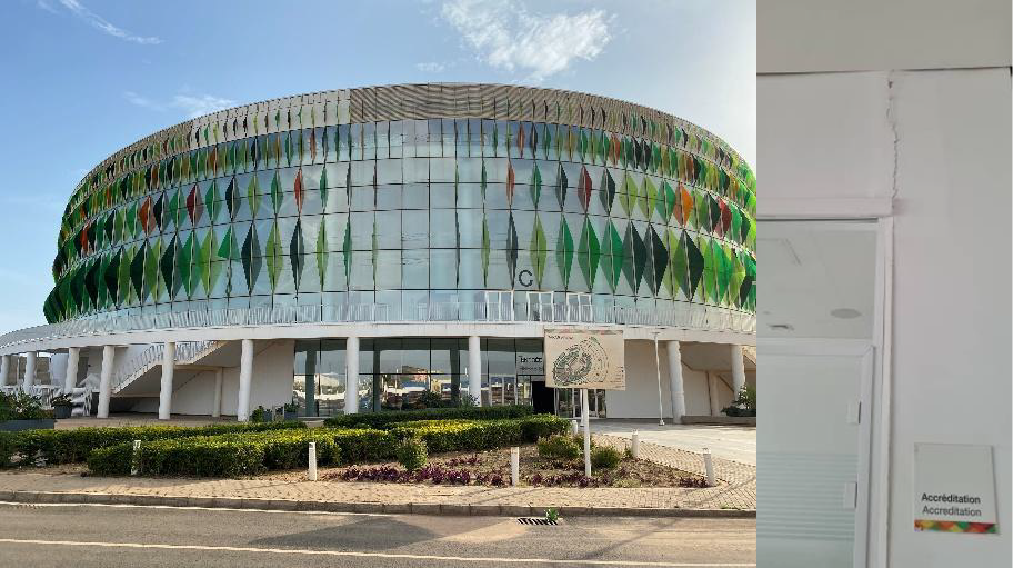
Basketball Arena and cracks of the walls of the Arena
It often leads to lower efficiency and unwanted results. A vivid example we have found in Senegal, where a comprehensive geotechnical analysis has been performed over an area, using a traditional approach, and yet overlooked the fact that underlying swollen clays have a tendency to produce
large scale deformations during the rainy season. These deformations have an impact on the newly constructed objects, many of which are landmark buildings such as basketball arena or exhibition centre. The moving soils cause damage (cracks) to the walls and floors, destroy parking lots surface and pavements.
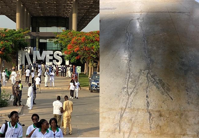
International exhibition centre and cracked concrete floors of the Centre.