Landslides Monitoring
Natural Hazards - Landslides
Landslides, which is defined as the movement down the slope of the mass of earth, rock, snow (avalanche) or debris under the force of gravitation, is one of the major hazards for the world’s sustainable development. The World Bank includes landslides in the list of 11 major hazards, along with floods, extreme heat, volcano eruptions, earthquakes, tsunami etc.
Landslides usually are triggered by external factors, mostly, rainfalls or earthquakes. Increased soil moisture for reasons other than rainfall, e.g. snow melting, or human activities may also trigger a landslide.
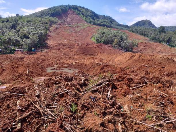
Landslide in the western Georgian region of Racha on August 4, 2023
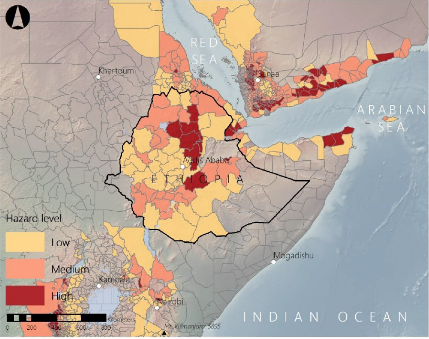
Aggregated landslide hazard estimate from the Global Landslide Hazard Map (source: The World Bank)
Landslides vary in size and scale, with the largest reaching over 100,000,000 m 2 . Also, landslides may have very different speeds from slowly crawling several mm/year to lightning 100s km/hour.
Over 10,000 people die annually because of landslides across the globe, according to different sources, the figure, most likely, is a gross underestimation.
The phenomenon also inflicts a huge material damage, destroying habitational areas and infrastructures.
Some of the latest accidents include a landslide in Georgia in August, 2023, when 11 people were dead; landslides resulting from the 2015 Nepal earthquakes are estimated to have caused more than 8,500 fatalities, 20,000 fatalities are estimated to have resulted from landslides which were triggered by the 2008 Wenchuan earthquake in China.
Some areas in the world show very high susceptivity to the landslides while the phenomenon is unseen in some other parts. National Geological Survey of Norway and The World Bank undertake to produce highly useful world landslide risk maps, as well as classify the landsides and the risks they pose.
The creation of EGMS – European Ground Motion Service, the first service in the world, which provides free of charge baseline deformation information on the continental (Western Europe) scale, including landslides information is also an important step, which is called to help all responsible organization better manage the risks.
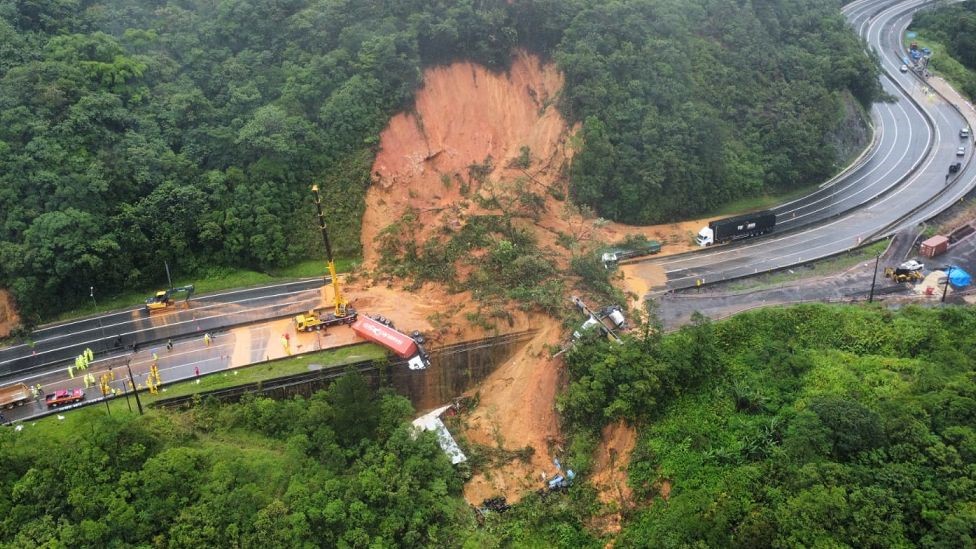
Deadly landslide in Brasil (source: BBC News)
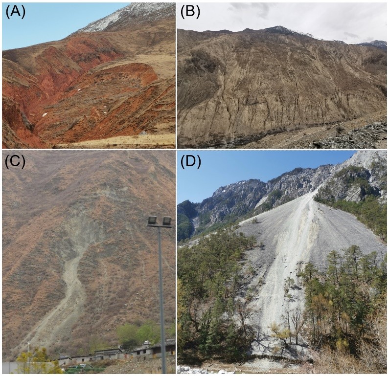
Qinghai–Tibet Plateau landslides
As with any other geohazard the landslides require close observation and proper risk management.
InSAR is one of the most effective, if not the only tool, to monitor for landslides and generate early warnings. InSAR is in a unique position given its high sensitivity to change, i.e. mm precision, which allows to detect very early land movements and track their spatial and temporal evolution, the ability to cover very large areas, which would not be possible to do using conventional tools such as land surveying, or sensors and low costs.
InSAR has already been successfully used by many countries and their Civil protection agencies for the landslide risks monitoring. One of the examples can be Italy, where the method has been used to monitor for land stability in Valle d’Aosta and many other areas. Another example could be Qinghai–Tibet Plateau, where large landslides often destroy the road resulting in traffic disruptions and casualties.
GeoKinesia possesses strong experience in providing landslides deformations monitoring service to the public customers in Europe and across the world and has developed a unique early warning tool, which allows generating in automatic manner early warning signals and track land deformation risks and their development. We work on the development of the most advanced early warning system, which would become an effective tool for landslides risks management.